Day 1: Headquarters (~2600 ft) to Mississippi Lake (~2200 ft), ~11 miles, lots of ups and downs
Corral Trail, Spring Trail, Manzanita Point Rd., Madrone Soda Springs Trail, Mile Trail to China Hole (~1200 ft); The Narrows to Los Cruzeros (~1200 ft); Willow Ridge Trail to Willow Ridge Rd. (~2600 ft), along Rollercoaster Ridge to Mississippi Lake (2200 ft); camp near dam on south side.
On the neverending Rollercoaster Ridge:

Day 2: rest, stroll around Mississippi Lake, change of camp sites to northern end with picnic table, walk up to County Line Road.
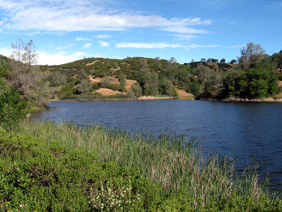
Mississippi Lake:
Day 3: Mississippi Lake (~2200 ft) to Arnold Horse Camp (~1300 ft), ~7 miles
Bear Springs Rd., Bear Mountain Rd. (~2500 ft) to East Fork Coyote Creek (~1400 ft), allong East Fork Coyote Creek to Arnold Horse Camp (~1300 ft).
Not surprisingly, more ups and downs in Henry Coe:

Day 4: Arnold Horse Camp (~1300 ft) to Headquarters (~2600 ft), ~7.5 miles
The Narrows (~1200 ft), Schafer Corral Trail, Poverty Flat Rd. (~1800 ft) to Poverty Flat (~1200 ft); up on Poverty Flat Rd. to Manzanita Point Rd. (~2300 ft), Forest Trail, Corral Trail to Headquarters (~2600 ft).
The rain'll keep us cool:


